Wandrer News
Map Update: Data from May 7, 2026 now available
OpenStreetMap data as of May 7, 2026 is now available on Wandrer. If you’re upgraded, you can request the update on your settings page. You can also request to keep your map data updated, but this means only that you’ll get updated eventually, not soon.
Read article
Onward to 2026
Hello! Welcome to 2026 and hopefully things have been starting to dry out and warm up enough for you to get outside this year. Big things have been happening at the Wandrer Worldwide Headquarters, the first being that…
Read article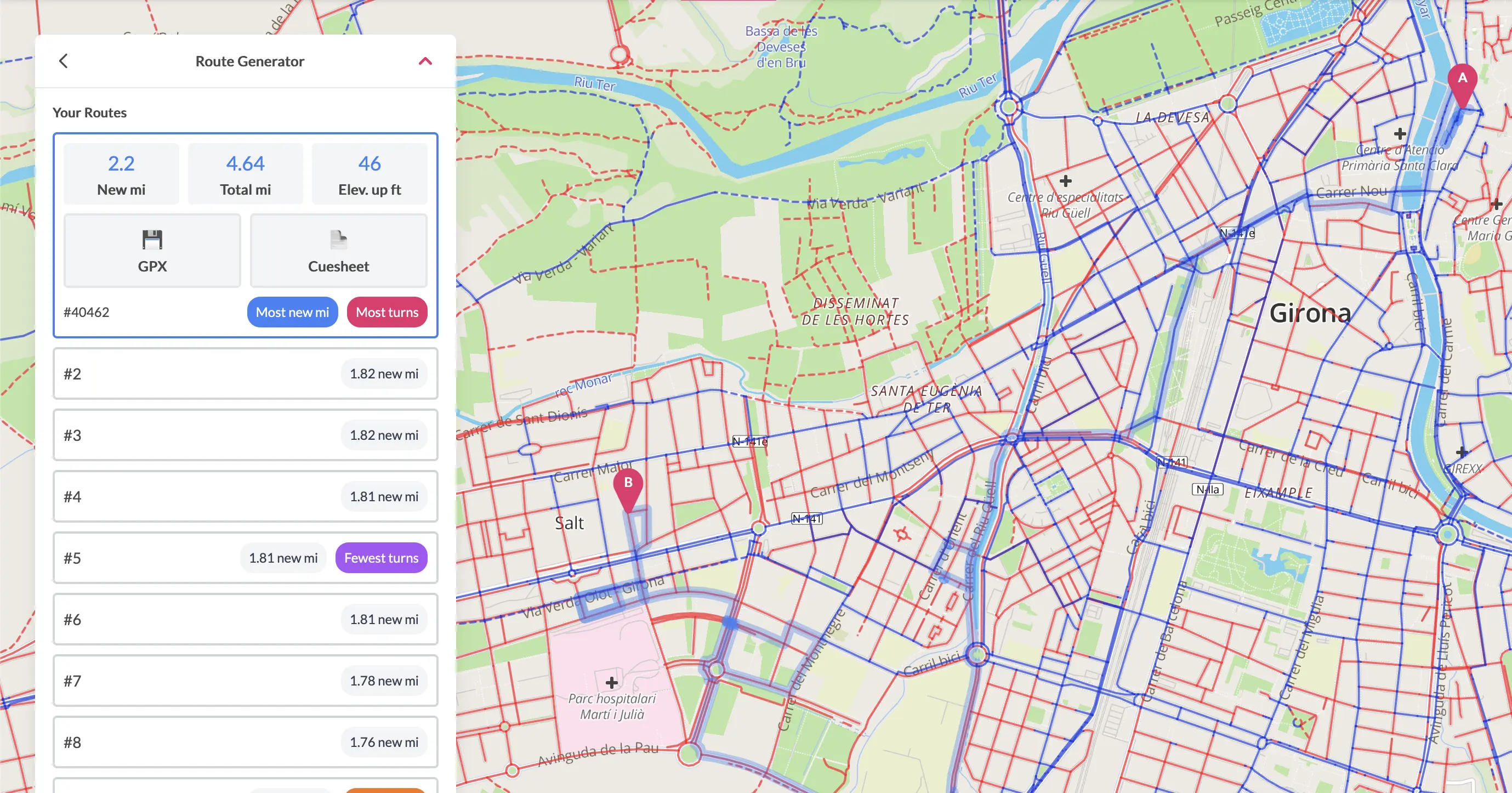
A->B routing is live
Following up on the recent post about “100% routing” tools, there are also now some tools to help you plan routes from point A to point B and maximize your new roads along the way. Let me tell you about it!
Read article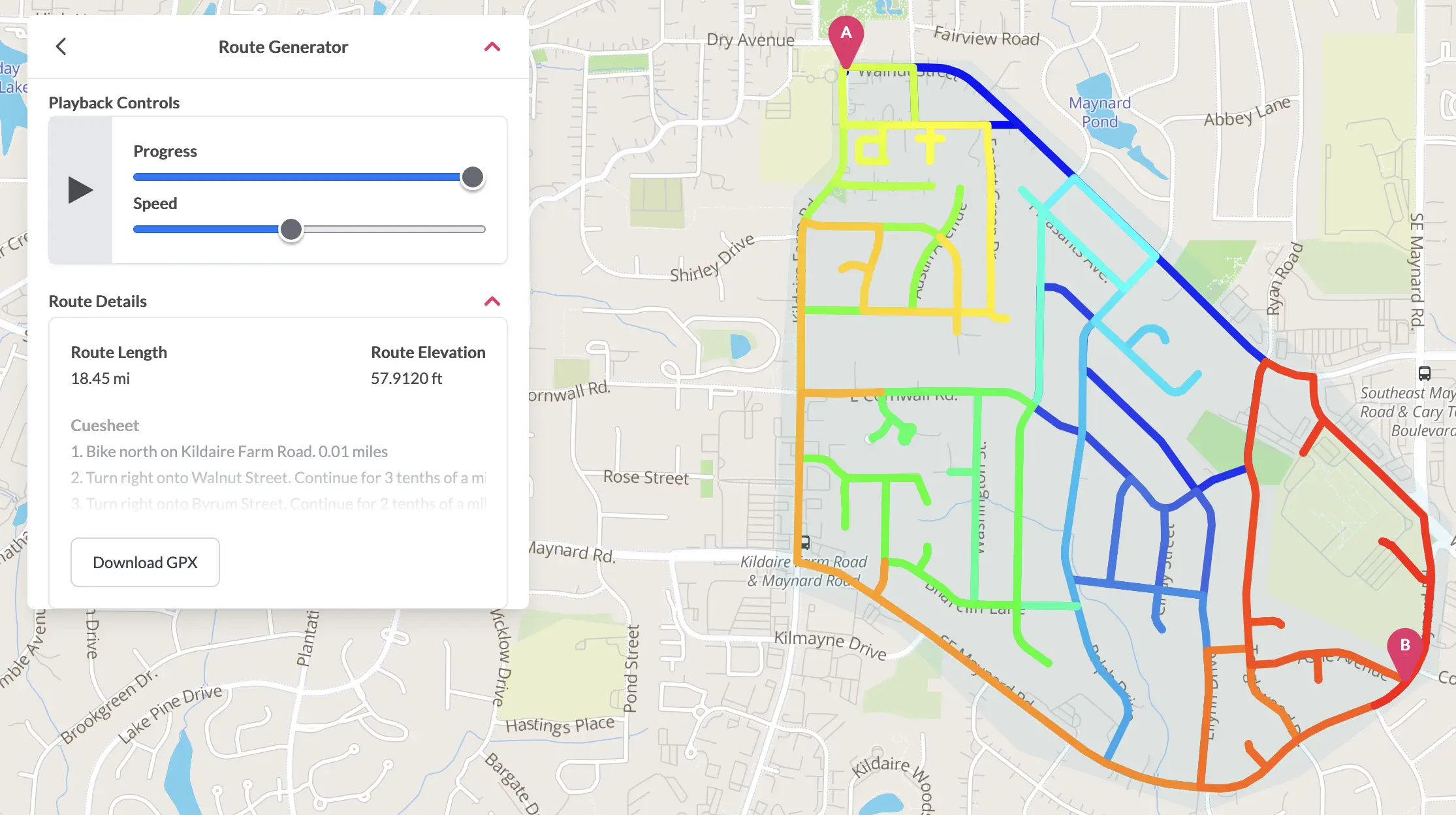
"100% routing" is live
As much fun as it is to go knock out a bunch of untraveled roads, sometimes you just want to do something without a ton of planning. Wandrer now has “100% routing” tools for you, which will let you easily make a route that covers every road in an area all in one go.
Read article