Summer is here!
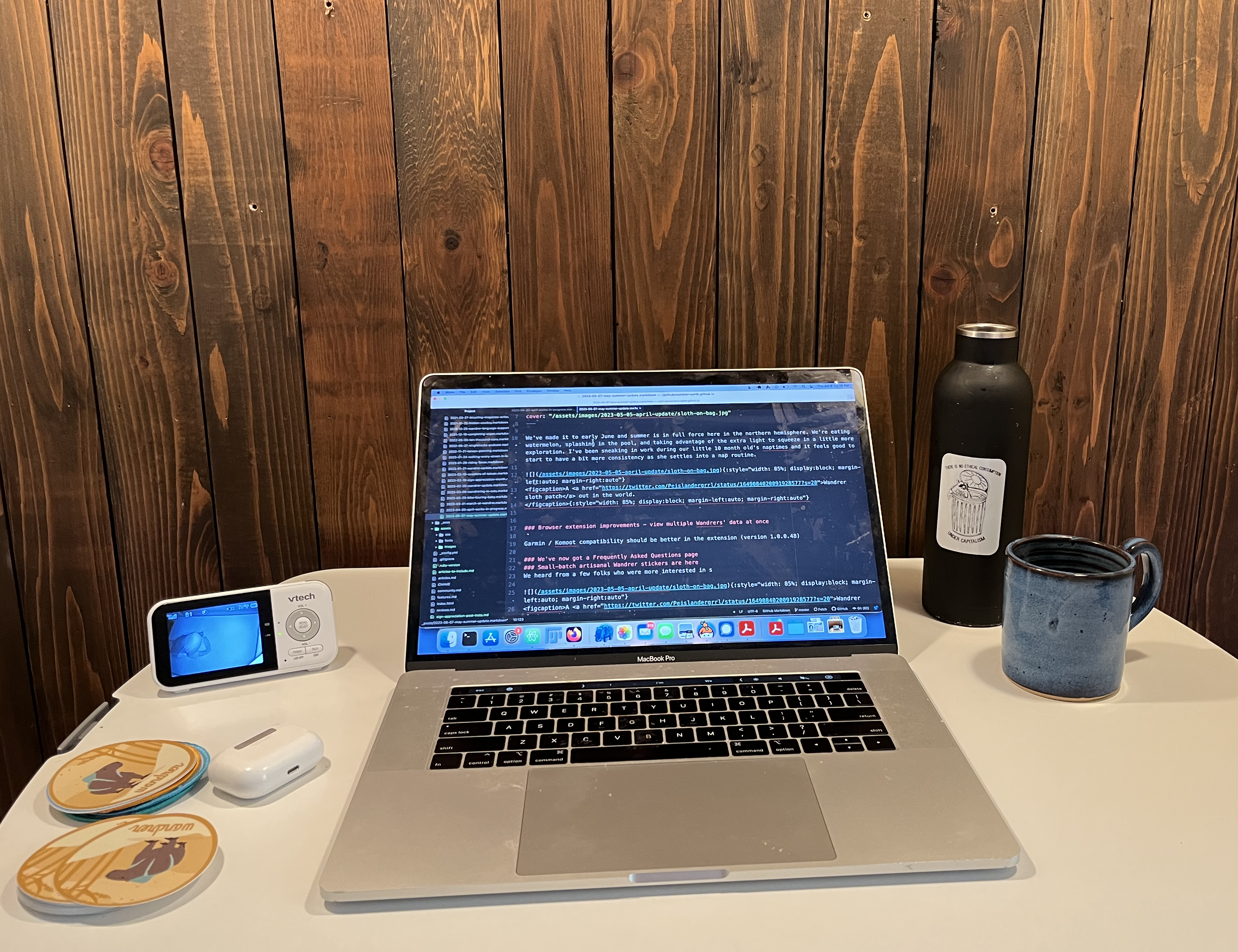
We’ve made it to early June and summer is in full force here in the northern hemisphere. We’re eating watermelon, splashing in the pool, and taking advantage of the extra light to squeeze in a little more exploration. I’ve been sneaking in work during our little 10 month old’s naptimes and it feels good to start to have a bit more consistency as she settles into a nap routine.
Here’s what we’ve been working on for the last month:
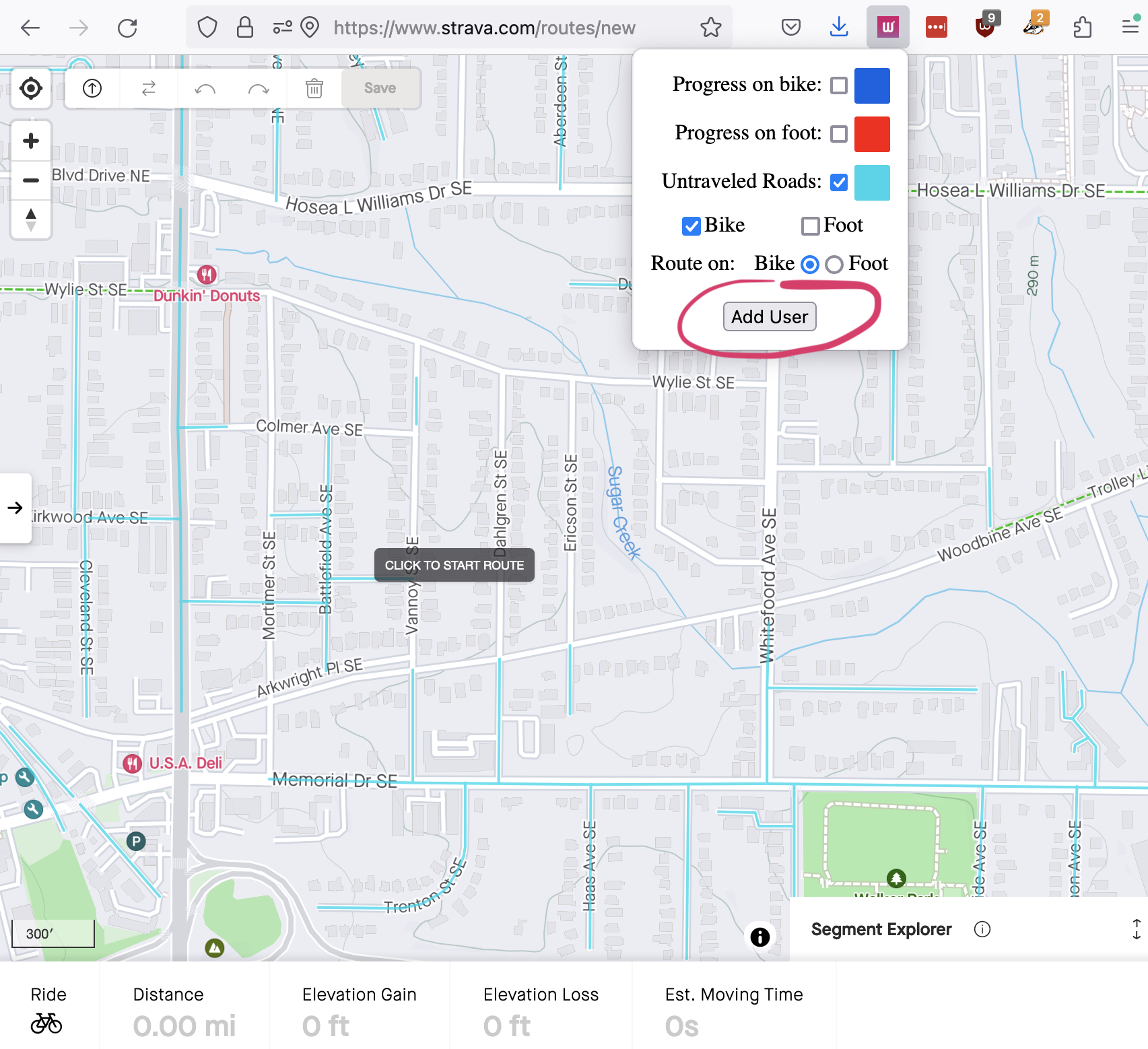
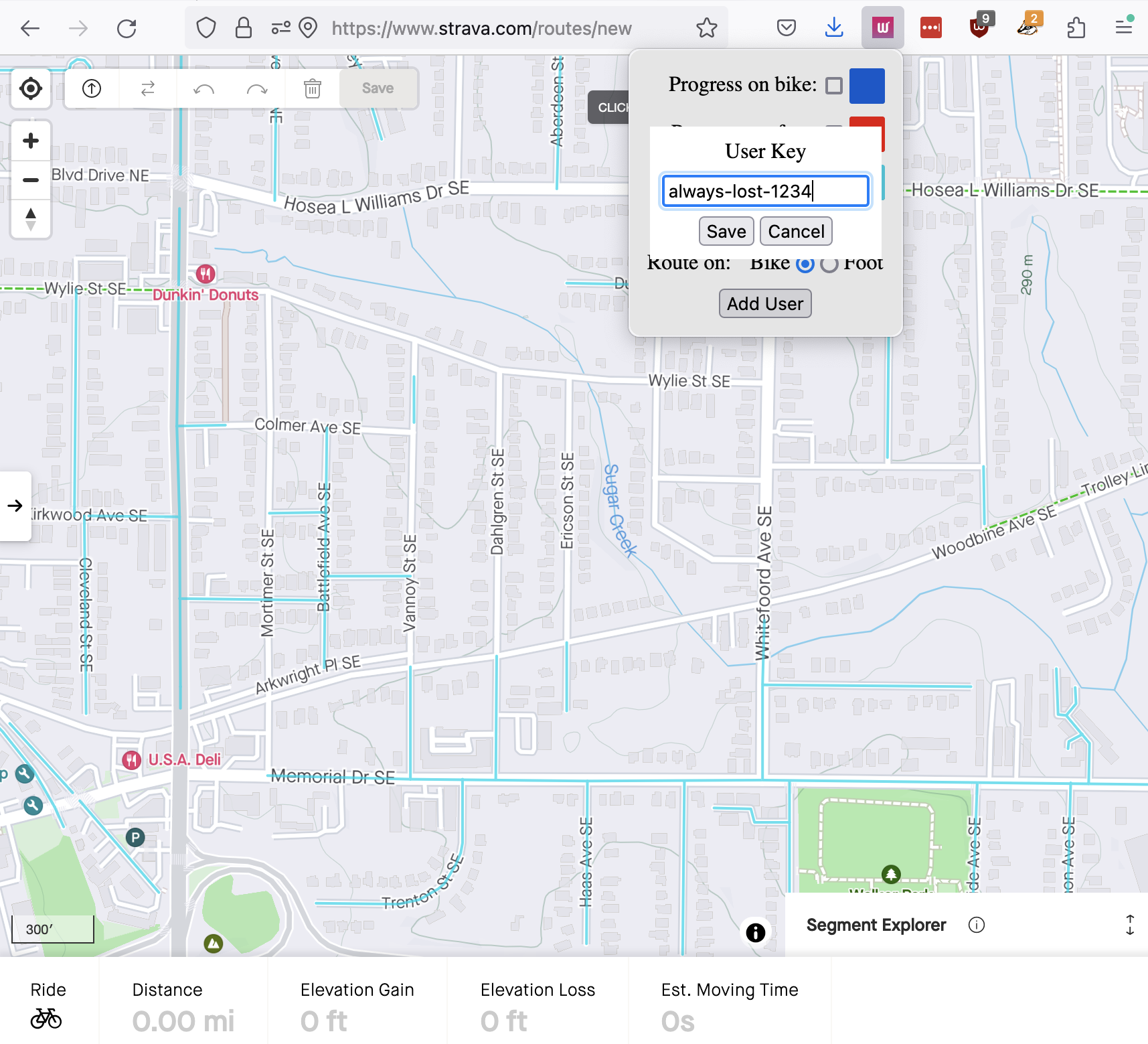
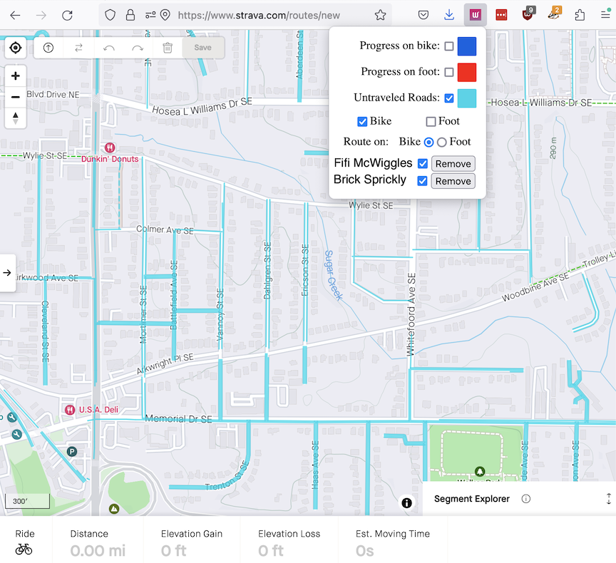
Go someplace together! Improvements to the browser extension
Craig has added a new feature to the Wandrer browser extension. If you update your browser extension to at least version 1.0.0.50, you’ll be able to add other Wandrers to your extension in order to view their data in addition to yours (note: they must be upgraded Wandrers as well). We hope this feature makes it easier to get out and explore with your friends while maximizing new roads for everyone. Unfortunately, this feature won’t work with RideWithGPS at the moment due a technical limitation on how we display the map overlay on the RideWithGPS website. In addition to developing this feature, Craig also improved compatibility with the Garmin and Komoot websites during this past month.
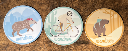
Small-batch artisanal Wandrer stickers are here
We heard from a few folks who were more interested in sticker versions of our patches. I ordered a small batch of stickers as a test run. They are matte, 3”/7.5cm circles and pleasant muted colors. The cost is $5 per sticker including shipping. If you’re interested in buying a sticker(s), please email me to start your order. Hurry, we only have 10 of each! If demand is high, we’ll place a larger batch order.
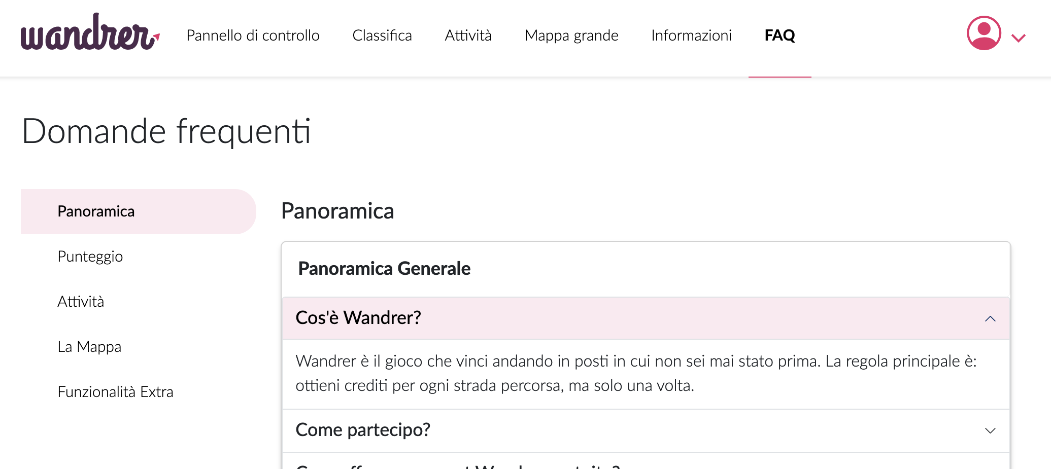
Got a question? We may have an answer available right away
This month I finished writing our new Frequently Asked Questions page. The FAQ link is located on Wandrer’s header and available at https://wandrer.earth/faq. Of course, if your question isn’t answered on that page, please do continue to reach out. We’ll continue to update the FAQ page based on the questions we receive.
Map data transition
Since my last update, Craig has continued working on transitioning to a new way of referencing our map data. In order to make this transition, we have to make sure our current data is accurately captured by the new data and double check to make sure our current data doesn’t contain any unexpected bugs. We’re excited about where we’re going with the new system because it will allow us to develop new features we’ve wanted to release for a long time. Fret not, we’re hard at work and we will bring back map updates once we’ve got the new system in place.
Media Rec
Towson University magazine wrote an article about Wandrer Elliott Plack, who has run 100% of Towson, Maryland US (579 streets, 179 mi / 288 km). Now he’s targeting Baltimore County, a bigger project with 4176 mi / 6720 km. Good luck, Elliott!
That’s all I have for this month’s update. As always, reach out if you have any questions. I’ll leave you with this collection of images from our adventures this past month. Happy exploring!
Related Stories:
Onward to 2026
Hello! Welcome to 2026 and hopefully things have been starting to dry out and warm up enough for you to get outside this year. Big things have been happening at the Wandrer Worldwide Headquarters, the first being that…
Read articleA->B routing is live
Following up on the recent post about “100% routing” tools, there are also now some tools to help you plan routes from point A to point B and maximize your new roads along the way. Let me tell you about it!
Read article