The Final 10%: Tackling the Elusive "Highest Hanging Fruit"
It’s all fun and games setting out at first in a new town when every road is new. But once the percentage gets high, the going gets… weird.
The feeling of going to a new city and riding around aimlessly is wonderful – every which way you turn you’re seeing something new, and of course adding blue lines to your Big Map on Wandrer. What I’m about to describe is basically the opposite of that.
I’m talking about riding around very strategically in your own backyard so to speak - in a place where you’re already covered all my main thoroughfares and no doubt already been down all the best bike paths – and still trying to hit a few scraps of new road. It might not be carefree and wonderful to cover this elusive territory, but it is bound to be a weird adventure.
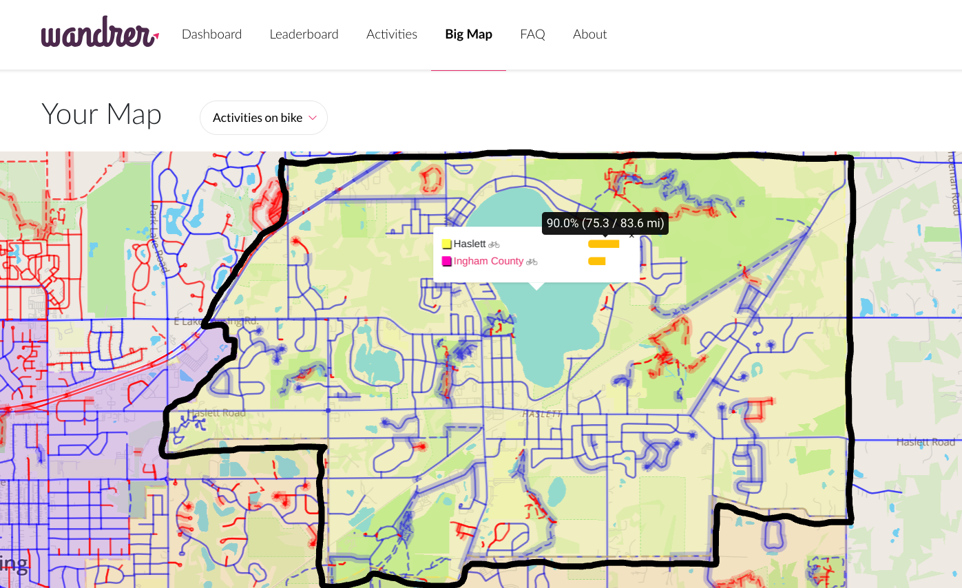
Having moved from Austin, TX to the Lansing, MI area in early 2022 meant I had a fresh new part of the country to explore on Wandrer. After a brief stint in south Lansing, I moved to Haslett, MI (suburb east of East Lansing, MI) at the end of 2022 and over the last ~15 months, I’ve just finally gotten up to the 90% completion threshold here in my little lake community. That was great, but of course I wanted more!
The Mission
The law of diminishing returns is not unique to Wandrer. Once you hit 90% completion with a task, it’s often the case that the final tenth of the work takes up a wildly disproportionate amount of time. For example, maybe it’s easy enough to get an A- on that exam, but it would have taken a ton more work to get a perfect score. So it should come as no surprise that each road remaining on my local community’s map has … a catch to it, we’ll say.
Essentially, at this point anything left on the map in the final 10% can be considered the “highest-hanging fruit” – the roads and paths that are tucked out of the way, perhaps not bike-friendly, difficult to navigate, or maybe even downright illegal to ride. My self-assigned mission: attempt to ride as much of the remainder of my town (Haslett, MI) as possible in two hours, and document my findings.
Route Planning: Getting the Gears Turning
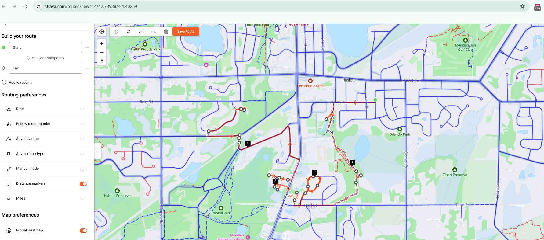
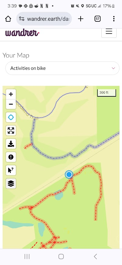
I set out on a Saturday with about a 2-hour window of time to ride (the duration of my 2-year old son’s afternoon nap). I first created a route on Strava, using my Wandrer Map Overlay browser extension to provide me a color-coded reference of which roads I haven’t covered yet. I then loaded that route onto my Garmin Edge 530.
Obstacles and Oddities Along the Way
Spoiler alert: I didn’t end up following the route I had planned to a tee, since it wasn’t exactly feasible. In fact, I was surprised by how many different challenges I was presented with along the way, ranging from natural to man-made. I did, however, have fun getting out there and wandring! Here’s an overview of what I encountered out on my mission – not necessarily in chronological order, but instead starting with the tamest, then leading up to the toughest:
Lemonade Stand Sisters
Yes, this really happened. Thanks to my oddly specific knowledge of local roads, I felt empathy for their entrepreneurial pursuit, seeing as they were located on an obscure dead-end street and bound to get very little foot traffic. They seemed excited to see anybody, and were beyond thrilled when I gave them a $10 bill and said I didn’t need change. It’s the little things. (editor’s note: we have a rule that if you’re out riding and see kids selling something on the side of the road, you’re required to stop and buy it. So far this has meant buying candy, advice, cookies, lemonade, cupcakes, tickets to play home-made games, and original art)
New Housing Developments
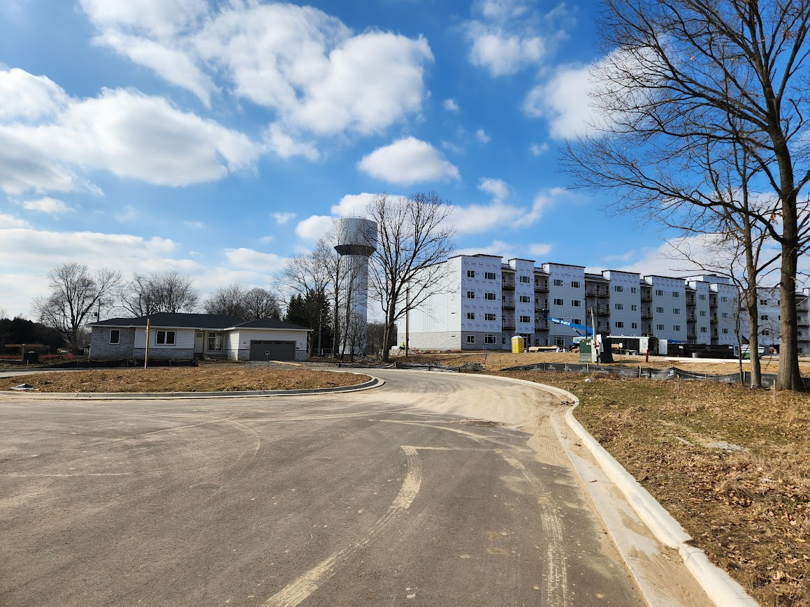
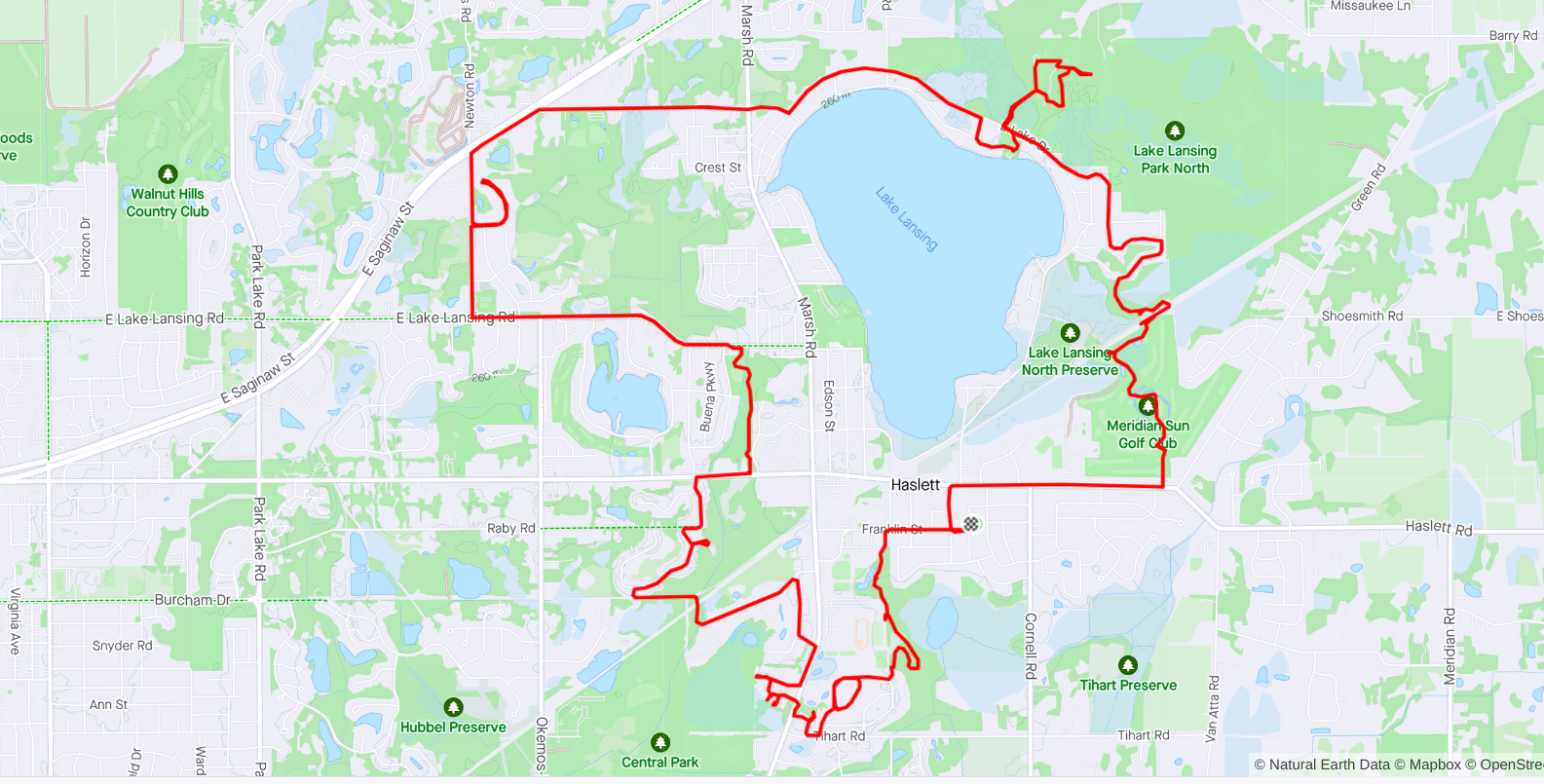
So which local roads are still untraveled at this point, (i.e. marked red on the Big Map) after dozens of my casual “wander-full” rides around town? Well, basically, not any “normal” thoroughfares or easily-accessible, well-worn paths. One such example would be newly-built subdivisions. Perhaps I was in this area last summer and it didn’t exist, or it wasn’t listed on Wandrer or Google Maps yet, or perhaps it was previously under construction and not rideable. Regardless, after a recent map update, it appears now… and hence checked off my list!
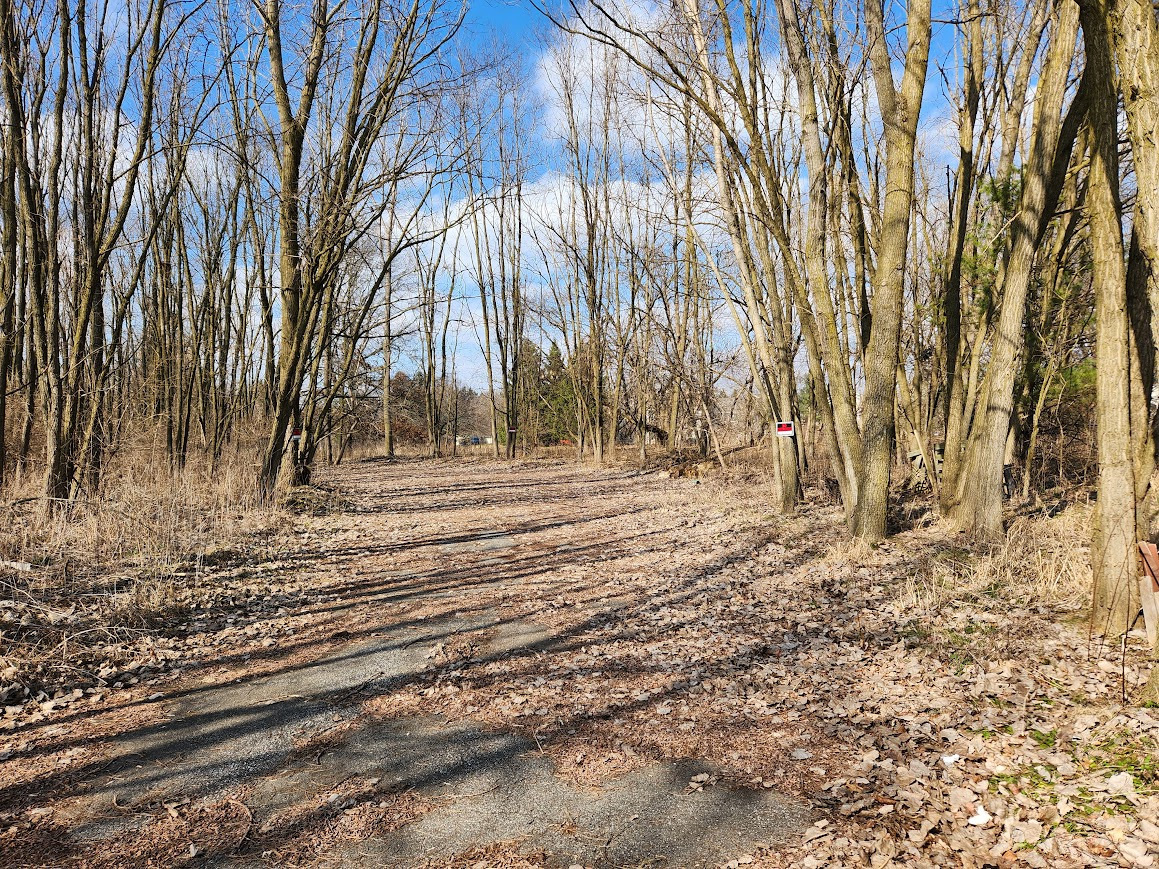
Dead-Ends & Cul-De-Sacs
Love them or hate them, dead ends and cul-de-sacs are a hallmark of Wandrer. In fact, they’re even tracked in your Wandrer year-in-review! Being more of a “Radial Looper” Wandrer than a “Neighborhood Completionist” by nature, I usually ignore these inefficient impasses. However, today, my mission dictated otherwise.
Now technically, a cul-de-sac refers to a short street with a bulbous, rounded end – the best kind, of course, feature a proper roundabout for us Wandrers to lean into the inevitable 180 with dignity.
On the other hand, a true “dead end” just abruptly ends at a point, and – unless it has one of those nifty secret cut-through paths leading to an adjoining road – they can range from mildly inconvenient to downright unsettling. The most obscure dead-ends with the least traffic are where the potential for weirdness is greatest. Case in point: a dirt driveway that leads to two houses may be considered a public road. But anyone who’s received the “what the hell are you doing riding here?!” look knows what I’m talking about.
![]()
![]()
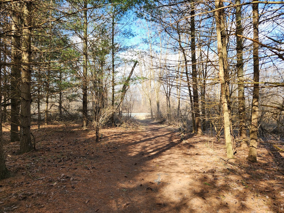
School Paths
To my surprise, a series of dirt trails running behind the local high school were listed as untraveled on Wandrer. These trails were a delight to ride upon on my gravel bike, but the lack of official signage begged the question: Can I be here? Is this trespassing? I believe the trails were part of the high school cross-country course, yet they also appeared open to the public, so I rode onward!
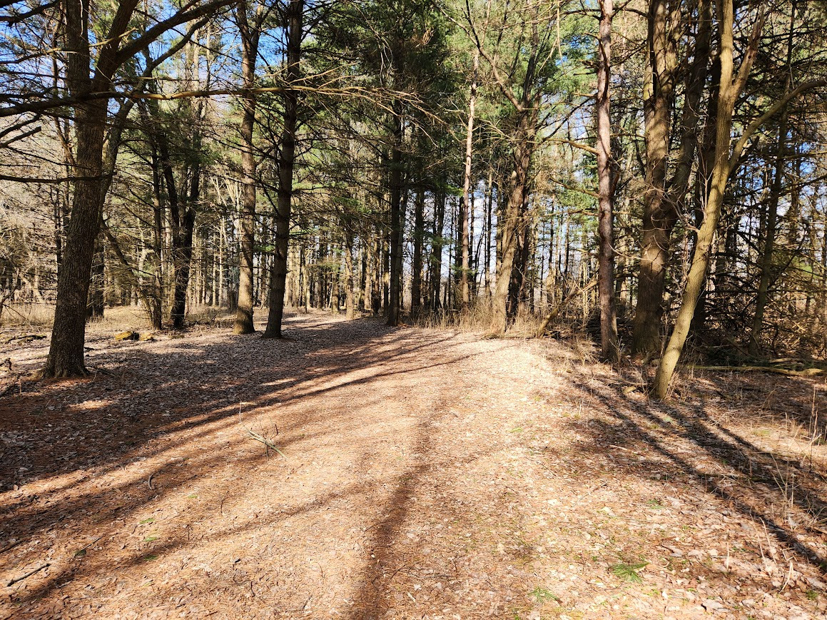
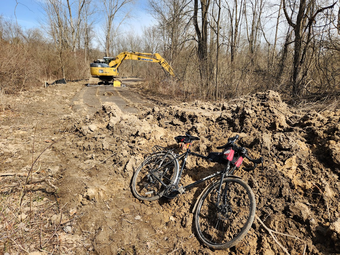
Trails-in-Progress
If you’re lucky enough to live in an area that is building new trails, there’s always the possibility that a new one sprung up! In my case, this recently created trail was in the process of getting leveled and eventually paved, but already existed on Wandrer and was marked untraveled. For now, it was mostly a well groomed gravel trail, until I got to a crane and a huge pile of dirt! A minor bypass through the woods made this obstacle easy enough to get around.
Unmaintained/Overgrown Trails
Other “untraveled” trails I came across evidently hadn’t been maintained in some time, which meant navigating with nonexistent trail blazes, hacking through overgrown brush, and getting around other “halfway-back-to-nature” features such as tall grass, mud, fallen limbs and dead leaves. Doable… but a little rugged. No wonder I hadn’t been here before!
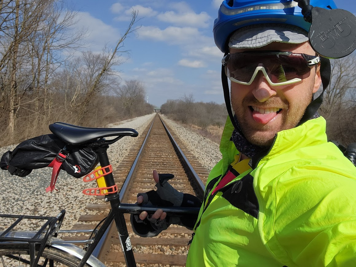
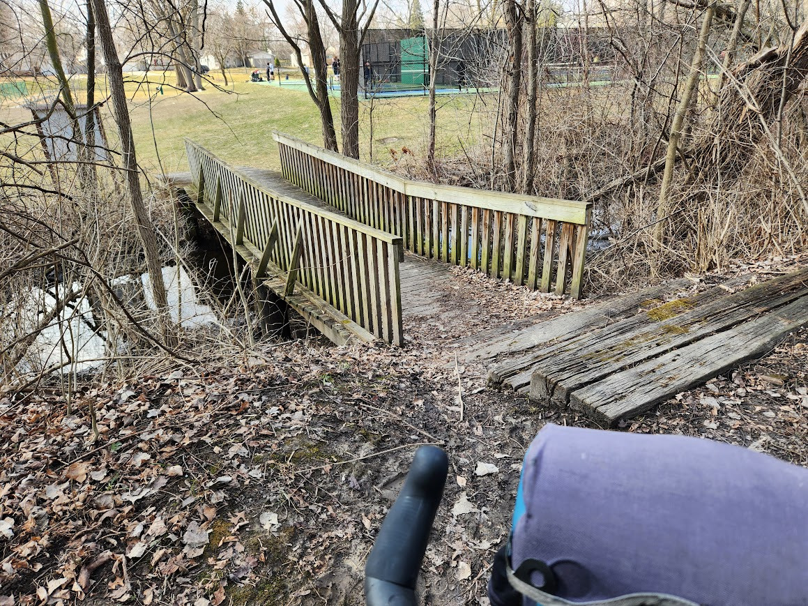
Portages/Hike-a-Bike Moments
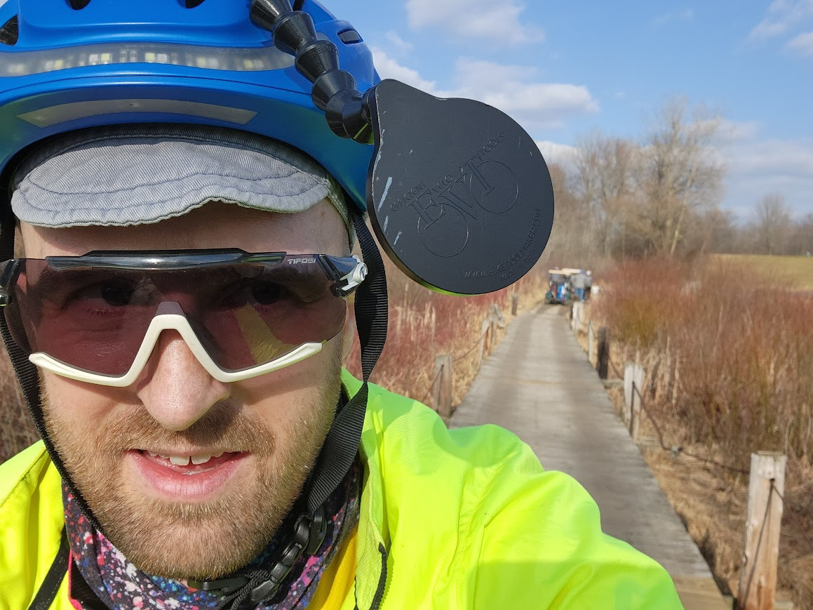
When tackling the most obscure paths and trails, sometimes a “bike portage” is necessary. This route had a few of these occasions - including an elevated railway crossing and some steps leading down to a footbridge crossing a creek. Both of these were easy enough, but definitely not the sort of thing I’d normally bother with.
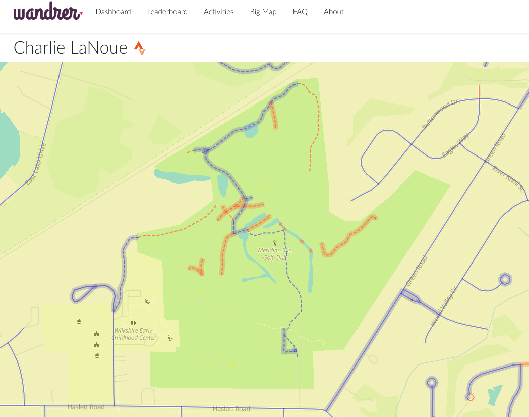
Golf Course Paths
I must confess; I’ve never been golfing. Unless mini-golf or disc golfing counts. That said, it was very much unclear to me whether a cyclist could simply ride into a golf course and bike around the various paths presumably reserved for paying golfers and their golf carts. Turns out, you can! (I guess.) No one seemed to mind as I squeezed past golf carts in narrow passageways.
I had been avoiding these “trails” for over a year, and I even took a weird incognito way into the golf course to avoid any awkward confrontation… more on that soon.
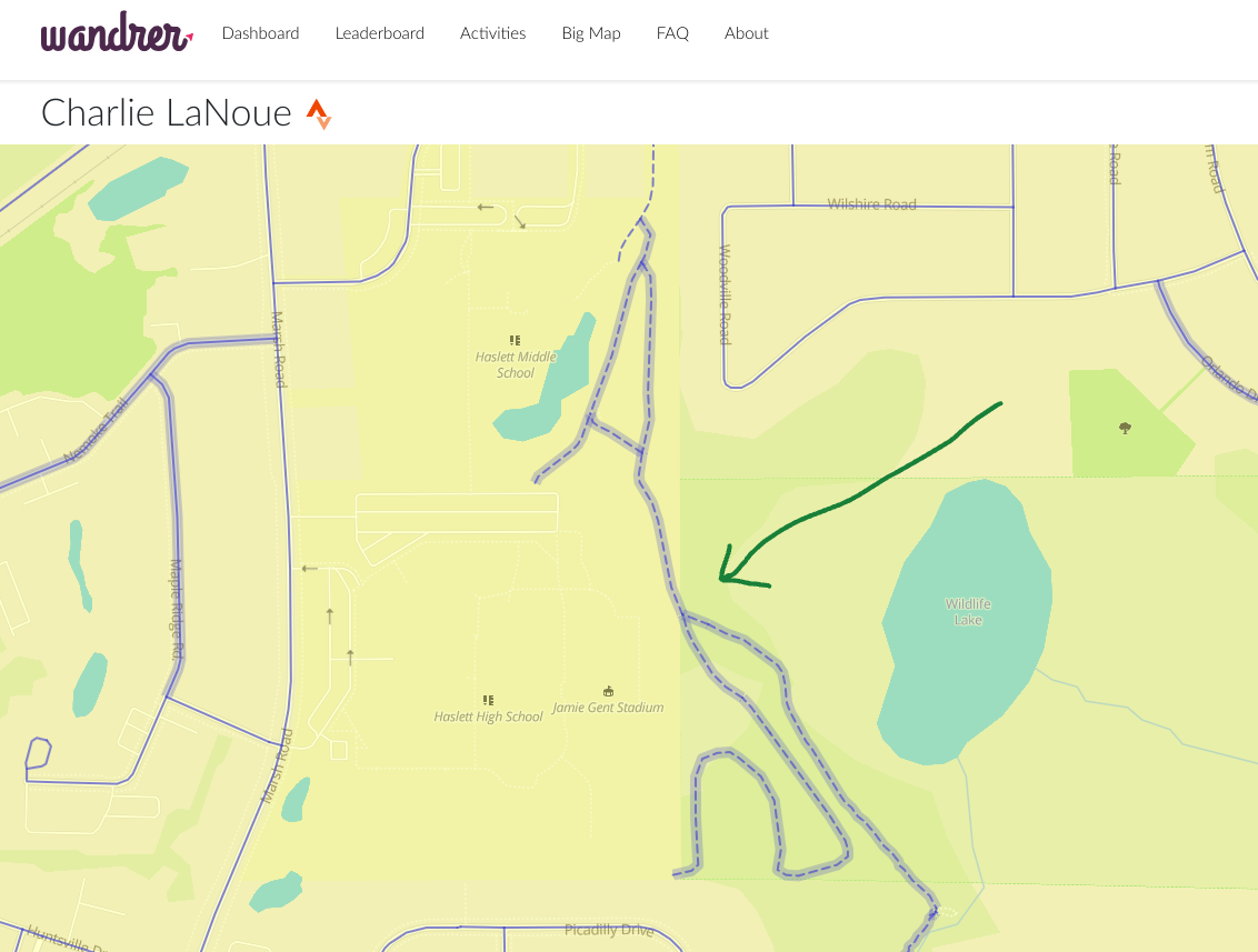
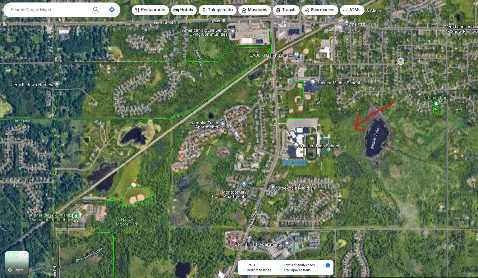
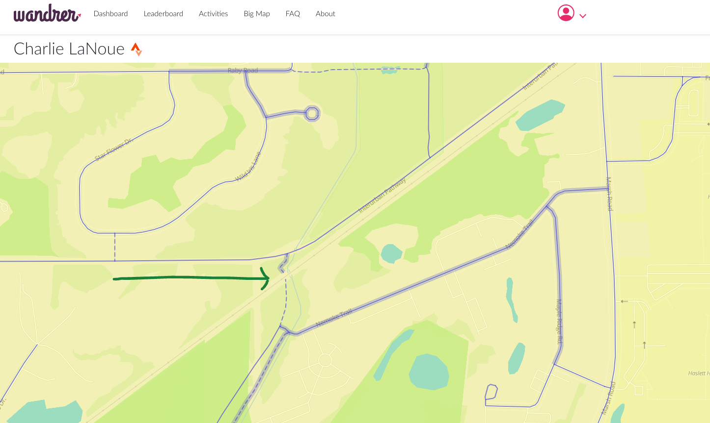
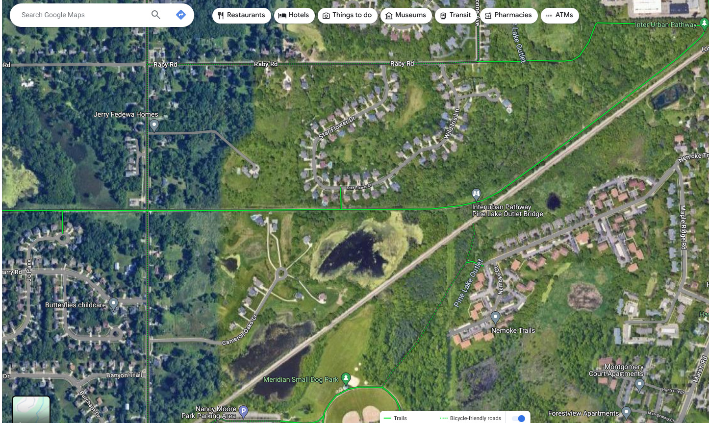
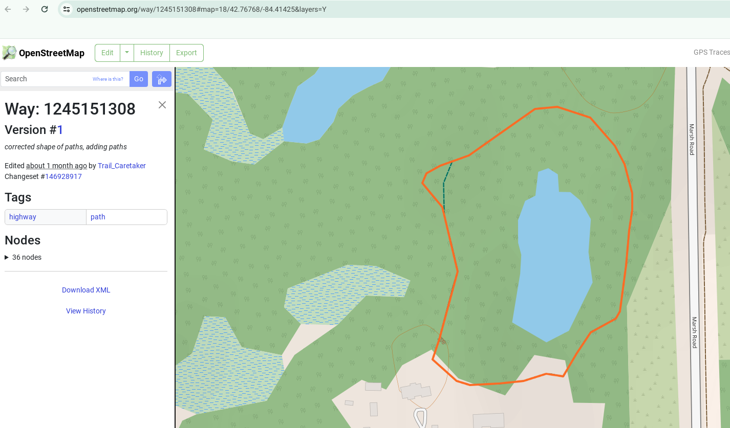
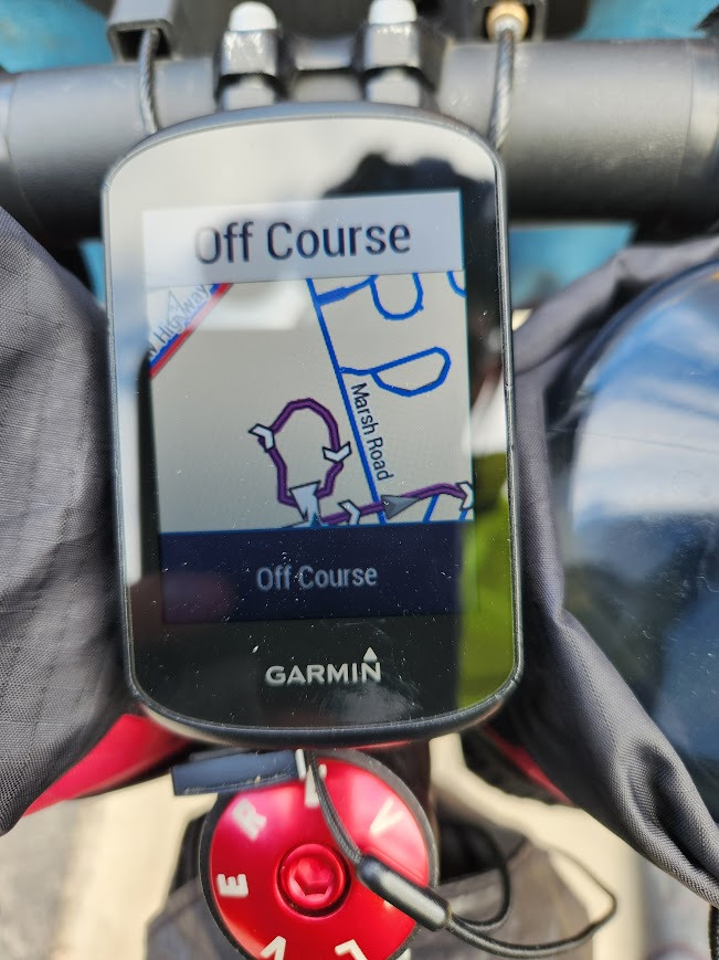
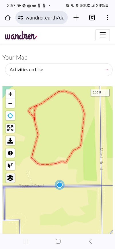
The Phantom Loop
This one was pretty bizarre. Or perhaps it was all just a big misunderstanding. So according to the dotted line on the Wandrer map (denoting a non-paved surface), there exists a small loop near the edge of town, across from a park. I assumed it was an obscure trail with a trailhead hardly visible from the road, seeing as I’d ridden by here before and never seen any trails on that side of the road. That should have been a red flag. (Come to think of it - having to use the “manual mode” when building the route on Strava was another red flag).
After a few minutes of riding up and down Towner Rd looking endlessly, then checking different maps (my Garmin Edge, my Wandrer map, Google maps) I made the determination that this must be some weird private loop in someone’s backyard. This one remains a mystery for now…
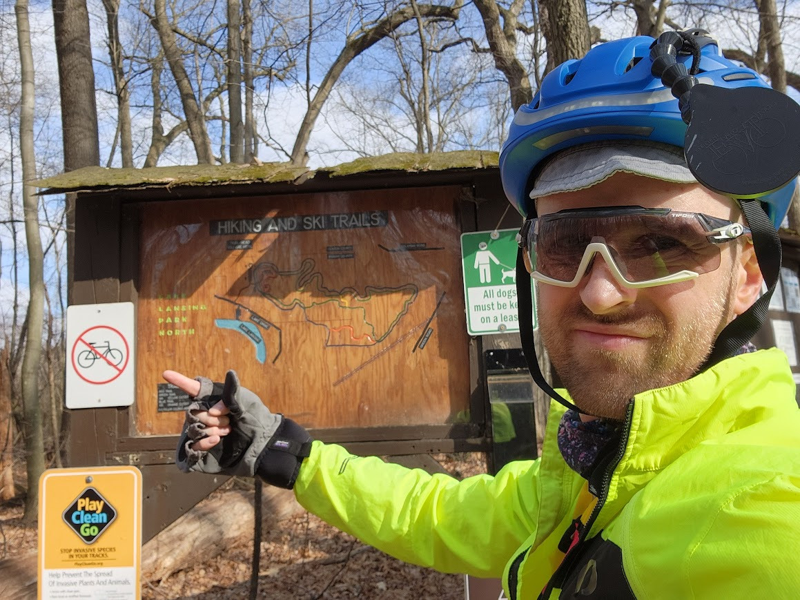
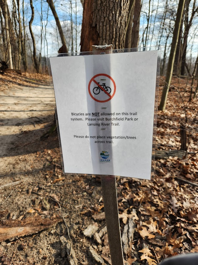
Trails with No Biking Signs
Not every trail marked on Wandrer as “bikeable” is, per se, bikeable. At least if you are following local ordinances. Much to my disappointment, I found out this was the case here at Lake Lansing Park North. Great park, by the way, (I’ve enjoyed hiking here) but these fun-looking rooty singletracks are off limits to two-wheelers. A bummer, too, since the route I planned to take led through this park and out the other side. Time to detour! Plans derailed but spirits still high, I figured a handy little shortcut would be just the thing to get me back on track…
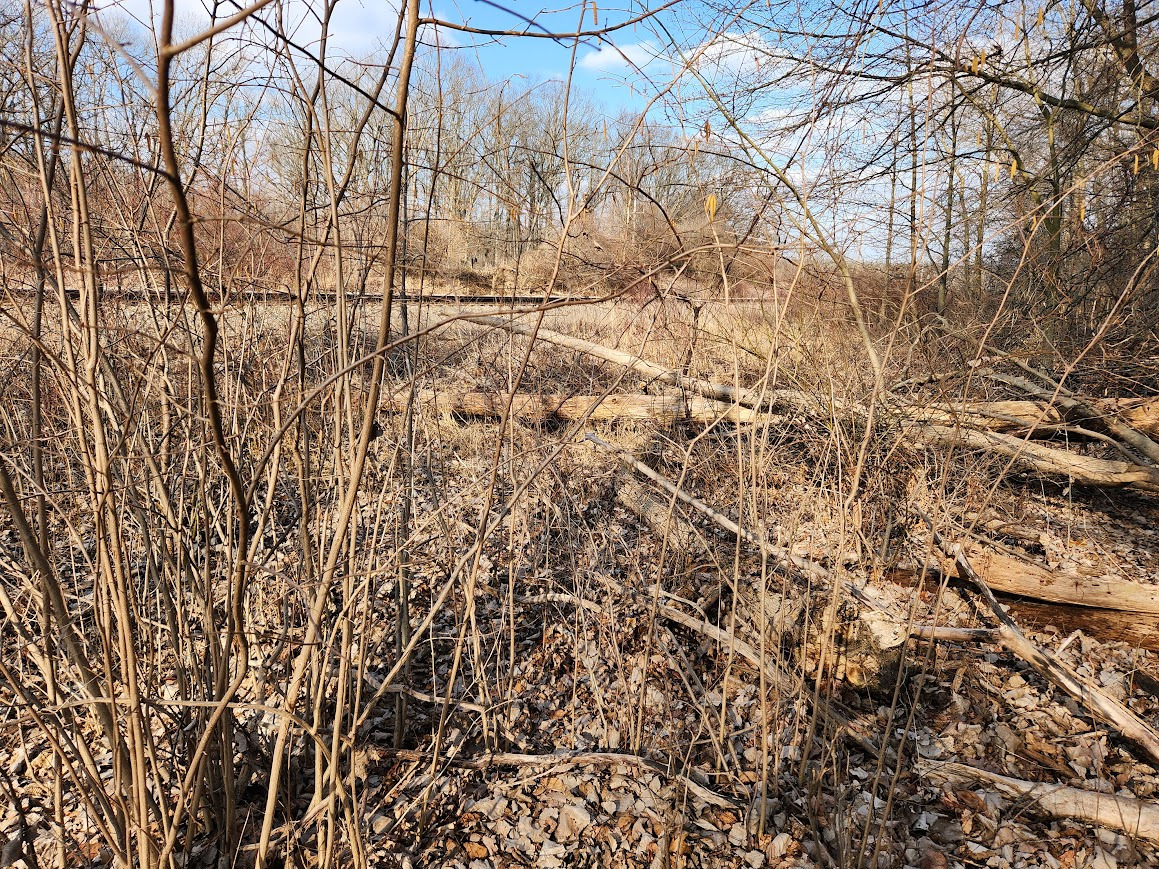
An Ill-Advised Shortcut
I’ll come right out and admit this one was probably my fault. I didn’t have to attempt this “shortcut” but it seemed so easy when looking at the map. Plus my originally intended route just got scrambled by the whole “no bikes allowed” situation just before. So, I decided to get creative here to save time. Or, at least, that was the idea:
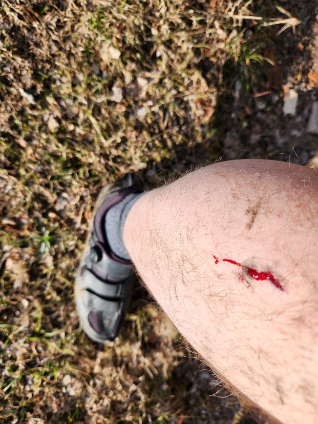
While these trails were a mere 300 feet or so apart, they were separated by a railroad track and nature. On the northwest side of the tracks, there were thick thorny brambles surrounding a swampy area where my cleats sunk in a whole foot (literally), unless I walked on top of the deadfall carrying my bike. On the southeast side of the tracks there were more brambles plus a steep uphill ravine to climb out of. Between the tick I found on my leg, the bloody gash from a thorn, and the gooey quicksand-like mud – I’m rating this shortcut a 0/10, never try again.
That said, I was pleasantly surprised when I emerged out of the woods at the golf course, got back on my bike, and simply rode off down the golf cart paths without a hitch. (I half-expected the golf police to be poised, waiting for me with handcuffs).
The Good, the Bad, and the Thorny
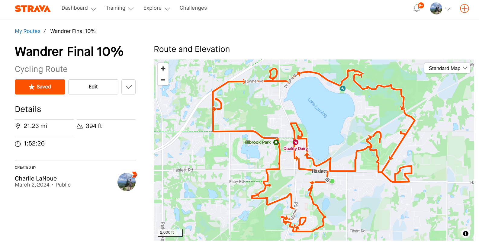
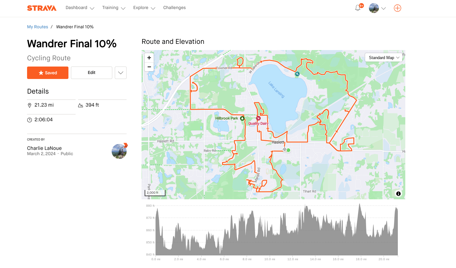
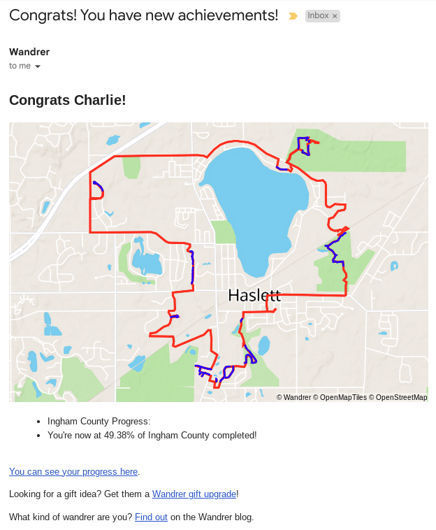
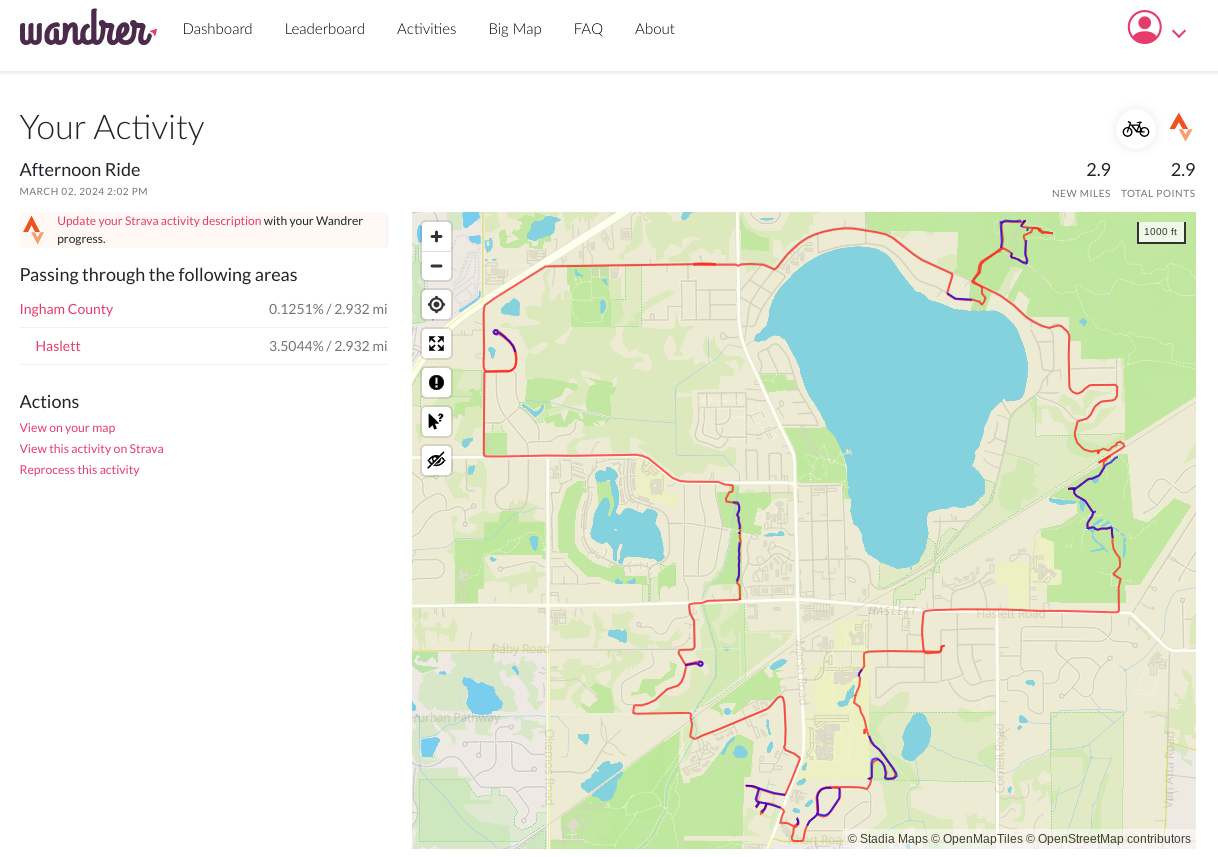
According to my Strava activity, I was out for 1 hr, 30 min of riding time over 1 hr, 50 min elapsed time, including about 20 minutes negotiating that regrettable shortcut. Of the ~15 miles I rode, 2.93 miles were “new” or previously untraveled by me, which netted me an additional 3.5% of Haslett. I suspect the next 3.5% would take perhaps double the time investment, and the final 3% might be near impossible. So it goes, in the final 10%. If it were easy, it wouldn’t be nearly as memorable.
Doing a ride like this – that is, heading straight into terra incognita or unexplored territory – comes with its share of twists and turns. Even moreso, when the trails and roads you set out to ride are the “highest-hanging fruit” within an area. You might hit some unexpected roadblocks or detours and have to adjust. My actual ride didn’t turn quite like I planned, and I’m okay with that. Maybe that’s the whole point.
Related Stories:
All Roads Lead To One
Ever wonder about the most prolific Wandrer in your nation? I know I have. I find myself wondering what their life is like… Are they totally obsessed with biking? What led them to this pursuit? How do they find time for all of this wandring? And what crazy stuff have they encountered along the way?
Read articleCompleting an entire country: Jérôme's Singapore COVID quest
A thousand km here, a thousand km there, pretty soon, you’re talking real distance.
Read article