Completing an entire country: Jérôme's Singapore COVID quest
A thousand km here, a thousand km there, pretty soon, you’re talking real distance.
It stands to reason that, as more and more folks are exploring more and more of their surroundings through Wandrer, eventually it would add up to some kind of crazy feat like completing an entire country.
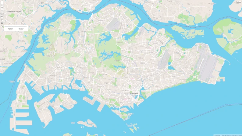
Even as someone who spends most of his time thinking about Wandrer, I had been getting distracted with pie-in-the-sky ideas like “I wonder if someone will ever complete 1% of the planet” (457,000 unique miles / 735,000 unique km), or micro-achievements like “All of Monaco” (40 unique miles / 64 unique km), that I completely missed the amazing feat that was happening under my own eyes: Jérôme Limozin steadily chipping away at Singapore (3093 unique mi / 4977 unique km), finally reaching 99% complete this past April.
I was first in touch with Jérôme in December, 2020, about (of course) editing OpenStreetMap and we’ve been in touch off and on throughout the years. We had a chat about his accomplishment, printed and lightly-edited below. All photos are taken by him.
Wandrer: What did completing 99% of Singapore feel like?
Jérôme: On that one ride when I reached 99%, it did not feel special, just another ride. I guess the reason is because in my mind I’ve already completed most of Singapore a while back (besides the Pulau Ubin island which is mostly for MTB and other MTB tracks… I am a roadie!). The last many rides I’ve done to accumulate new kms were giving very small results (few hundred meters…) and I had to mostly cleanup very small portions of roads not taken, like at crossings. On the ride I reached 99% I got 340m of new roads!
Also there are other people doing much more amazing stuff going so many more kilometers than I do, hundreds of miles every day.
For sure, it just feels like, you know, “an entire country”!
Yeah but it’s a small country, 5000 km. You can do that fairly quickly. The problem is there are so many small paths, not even paths, just junctions at intersections. If you look at OSM data for Singapore, because it’s very dense, and because of how the data is laid out, if you have two streets intersecting, by themselves that’s are 4 segments, and you have to travel it in both directions, plus you have to take all the 4 turns because they each also add a small OSM path for each of the small turns, like 10 meters.
Yes, this is a very annoying thing for me as well. That’s funny that you mention that the only place you haven’t biked is Pulau Ubin because that’s actually the only place I have biked in Singapore.
I’ve been there a few times many years ago. One time I went there and my parents were visiting, and we went to Pulau Ubin for the day. I had my mountain bike and my father had rented a mountain bike, and I had a big crash. I broke my two elbows at the same time, very far away from civilization, so that was 12 years ago and I didn’t go back after that. So I have a small piece of that island but otherwise no.
![]()
Did you enjoy the process of completing every road in Singapore?
Yes, very much. I started during COVID-19 confinement. In Singapore, at the height of restrictions, people couldn’t go out of their home besides very few exceptions. Running or cycling was allowed, as long as it started and ended from home.
I started going around my block, then expanded gradually trying to find all the roads in my neighbourhood. That’s when I discovered Wandrer, which I immediately started to use to go even further. This gave me a goal and a very simple metric (new kms) to measure progress, at a time I was mentally down due to the restrictions - Wandrer probably saved my mental sanity! I became very hooked and continued even after restrictions were lifted so maybe Wandrer actually created a mental issue, as I was very obsessed :)
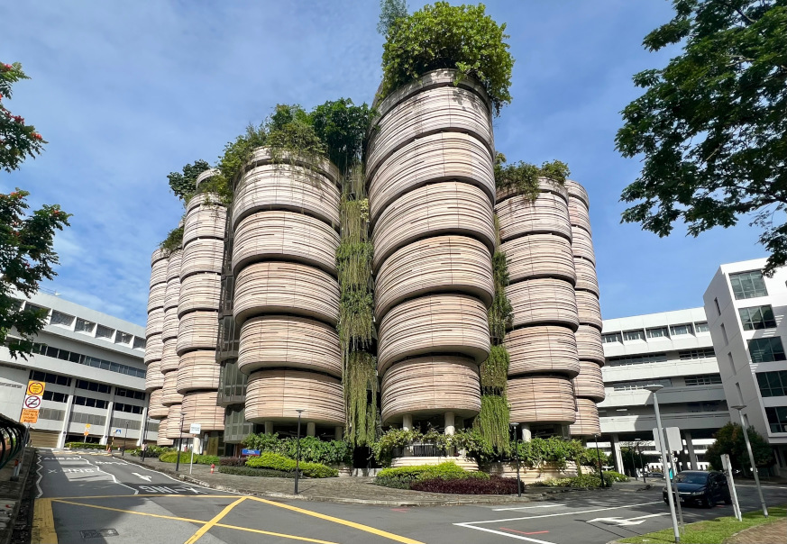
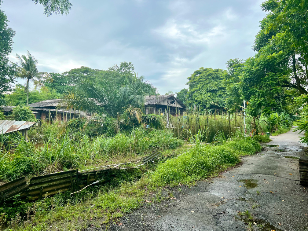
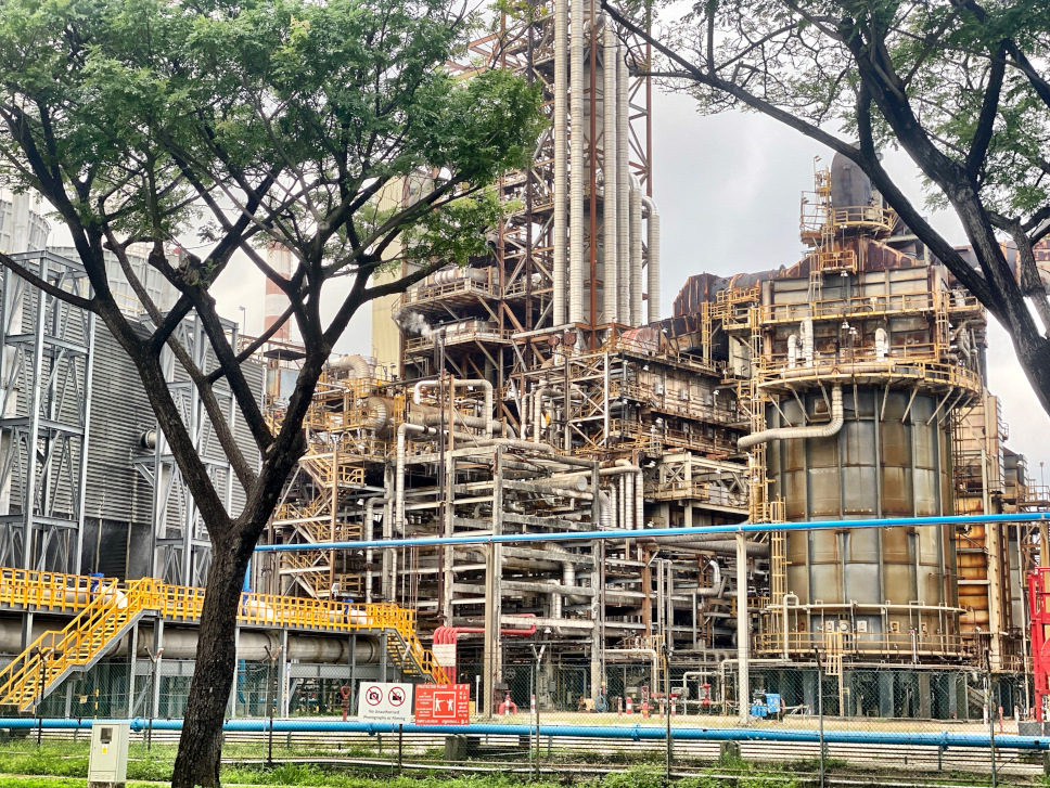
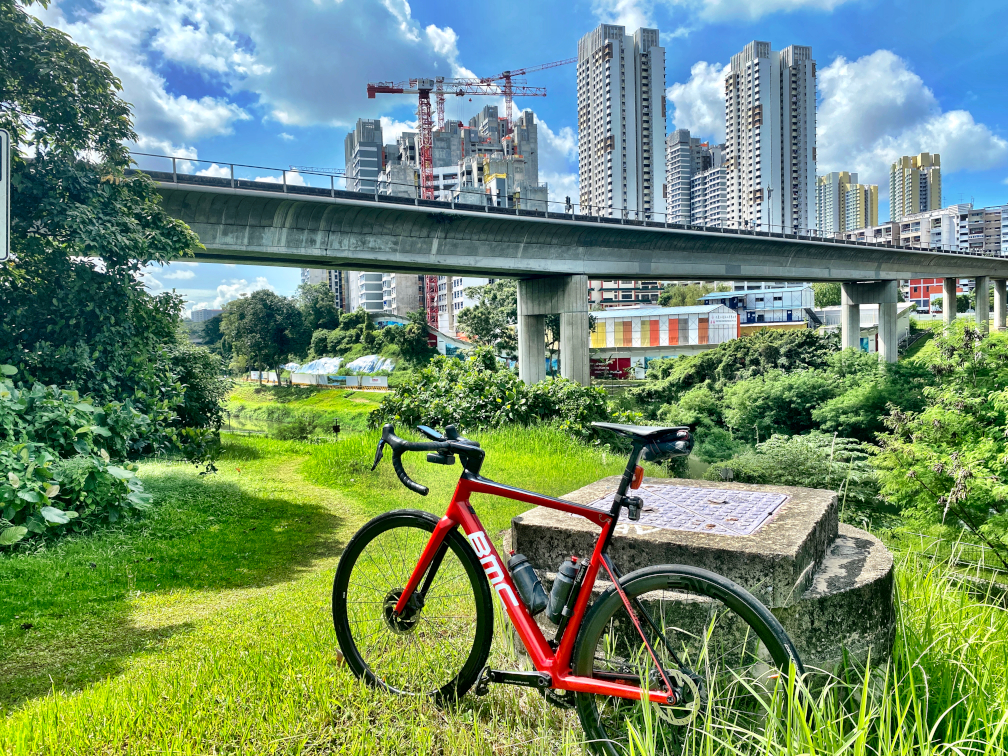
Another way I loved doing this is to discover Singapore and its huge variety. I took hundreds of pictures which I put in an album.
Do you feel like you understand something about Singapore that you didn’t before?
Singapore is a large and dense town with lots of buildings, yes, but it’s a lot more than that. Foreigners and Singaporeans know the central business district and Orchard Road, but there’s a lot more to Singapore. It is a whole country in only a few hundred square kilometers, so there is everything to see only a few dozen kilometers away: industrial places, a huge harbour, proper tropical jungle. There are many little streets and large ones, very picturesque houses and quite ugly industrial plants. A significant amount of temples of many different religions living in harmony close to each others…. it’s very varied and that’s what surprised me the most.
Would you do this again?
Yes! in my next chapter of life and when I’ll move to another place I will look forward to map the town or region I’ll live in. I probably won’t be able to do a full country though :)

So that’s a risk now right? If you update your map data on Wandrer, it might introduce new roads that you haven’t done. Are you ever going to do a map update on Wandrer, or do you want to just leave it perfect, as-is?
Oh no, I will because I want to see new roads that are being built. And Singapore interestingly is very dynamic. They build new roads all the time.
They create new park connectors quite a bit. There’s this government push to put fewer people in cars and more people to cycling/walking. So they are creating a lot more park connectors, which are really just extended pavement. Previously they were just for pedestrians but now they’re making them larger so you can go by bike as well. They mostly follow roads that exist today, but they are now distinct paths. So I want to go and travel them as soon as they are created. So I’m waiting for the next update :)
I bet most Singaporeans do not know Singapore as much as I do!
Were you doing this by yourself? Did you ever recruit anyone else to go walk your bike over some road that no longer exists or anything like that?
Very few times I was with people. Usually it annoys them to go to a dead-end, back, another dead-end, back. One time I went with a friend, he showed me some of the gravel paths that I hadn’t done, but they were pretty easy. So that one time we went to very gravelly place which was very fun and because we had to follow the OSM path then obviously it leads you to some stuff which is not really…
But you have to do it to discover if it’s rideable, right?
What surprised you about trying to bike every road in Singapore?
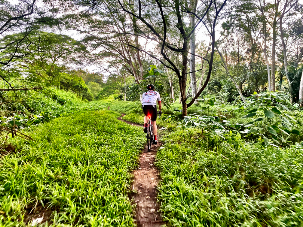
Some roads need to be taken 4 times! as they have a distinct OSM path for each direction, plus side pavements called ‘Park Connector (PCN)’ which are designated for bicycles and pedestrians. Bicycles are allowed on the road, but also on PCNs so one has to ride them 4 times at least.
Park Connectors are lovely, often in the nature and there are of course no cars. It’s shared with pedestrians so need to go slow but they allow discovering a deeper Singapore.
So I pulled up your OSM account, and you have 1342 edits, which is incredible! I think other Wandrer users can appreciate that there’s the aspect of actually cycling or walking the area, but then there’s this whole other side of it too about being meticulous in changing and updating the map, it’s like a dual effort there.
It’s surprising to me that OSM has been around for a long time, and you, having seen all of Singapore, you had a lot of stuff to change! And a lot of it has probably been that way for years until you came along and edited it. It’s just an interesting data point on the “correctness” of OpenStreetMap.
Yeah but then some of this is understandable: for a non-cyclist, a path is fine. But because I want to make a distinction I mark it as a footpath. There were a few other distinctions like with named roads, which normally match, but it’s the off-ramp of a highway, and you can’t ride it. That particular portion you have to mark as not for bicycles because there’s no way you can get on that. Really just a bunch of small things.
Yeah, I think OSM is doing a great job and is obviously very important for Wandrer. It’s just interesting to see what details can be wrong or slightly incorrect and persist for a long time. It only matters when it’s very important that this is a “footpath” and not a “path”. Do you think you’ll keep editing OSM?
Yes, I will as I see issues or updates needed. I want to continue to help as I can so that more cyclists have updated info about Singapore.
Any fun stories about people or situations you encountered?
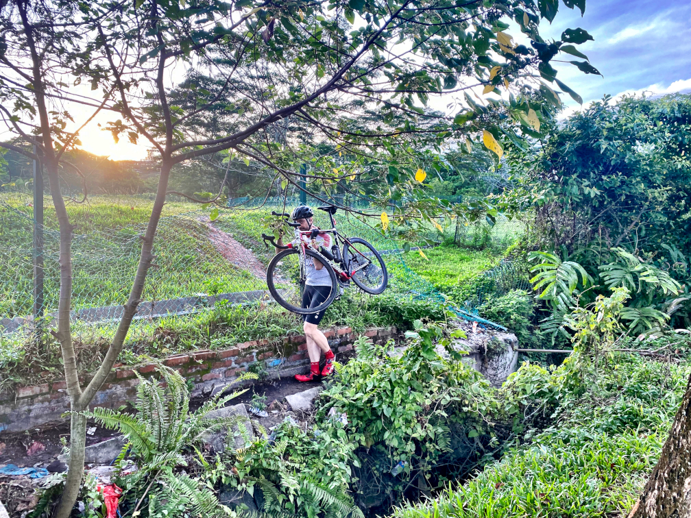
I have a proper road racing bike with skinny tires and I learned that it was a fine gravel bike too! Singapore is mostly paved but there are also quite a bit of gravel/unpaved paths that I took without much hesitation. I went to quite a few sketchy places but never punctured! Once I remember I went on a closed road which very quickly became non-paved and very damaged, but continued a very narrow single track in the jungle…. no one around… I kept going and carrying the bike (no bikes could pass, even an MTB) as the single track became nothing…. Then I carried on hoping to find an end to it. I was very stupid and very fun at the same time. I eventually managed to find an exit and a road but in hindsight it could have been dangerous if I had an accident trying to walk in the jungle with my road cycling cleat shoes!
Any suggestions for others?
- Use a route creation tool such as Strava, Komoot or RideWithGPS. Plan your ride in advance so you can maximise the new Kms and not waste time wondering where you should be wandering!
- I use RideWithGPS and I paid a subscription, not only to help the authors of this great tool but also because this allowed the option of having turn-by-turn directions spoken to me on headphones, which was super useful.
- I had my phone mounted on my handlebar, with RideWithGPS running so I could see the map in real-time. For headphones I use bone conduction ones which are much safer than regular in-ear headphones as I could still hear traffic as well as turning directions.
- Go slow and enjoy the journey, look around and take pictures! Cycling is the best way to discover new places.
- Update OSM, it will help others. It can be tedious but it’s worthwhile.
Related Stories:
All Roads Lead To One
Ever wonder about the most prolific Wandrer in your nation? I know I have. I find myself wondering what their life is like… Are they totally obsessed with biking? What led them to this pursuit? How do they find time for all of this wandring? And what crazy stuff have they encountered along the way?
Read articleThe Final 10%: Tackling the Elusive "Highest Hanging Fruit"
It’s all fun and games setting out at first in a new town when every road is new. But once the percentage gets high, the going gets… weird.
Read article