Onward to 2026
Hello! Welcome to 2026 and hopefully things have been starting to dry out and warm up enough for you to get outside this year. Big things have been happening at the Wandrer Worldwide Headquarters, the first being that…
We moved to Girona
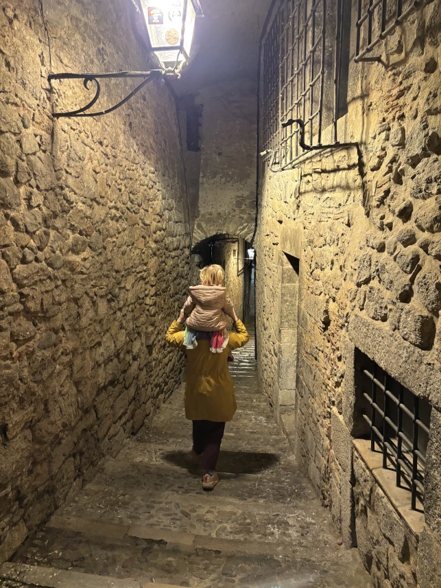
We moved in January to Girona, Spain and are having a bit of an adventure. Our daughter is rapidly learning Catalan and Spanish, the xuixos flow like wine, and the wine flows like rain, which stays mostly in the plains. It’s complicated.
We’re having a lot of fun and are starting to figure things out here. But if I didn’t respond to an email you sent towards the end of 2025, you may want to send it again. Things were a little hectic.
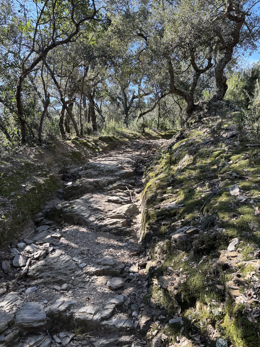
It turns out that the thing that cyclists have said about Girona for decades is true: it’s a great town for cycling. The roads are smooth, scenic, and quiet; the gravel is endless, brutal, and gorgeous; and the mountain biking is adventurous and improv (just the way I like it). You can’t go through the old town without hearing a swarm of freehubs, and you regularly see lots of big-name team kits out on the streets.
So far we have not made a ton of progress on turning our parasocial relationships with cycling podcasters in to real friendships, but we’re playing the long game. (DM me, Payson!)
2025 wrap-up
2025 was overall pretty good for Wandrer. It turns out people still like getting lost. Before we move on much farther, I want to thank you as Wandrer users for sustaining this weird thing. I am able to work on Wandrer because of you all, and since I occasionally receive lovely stories from folks telling me how much they like Wandrer (love these!), it should go the other way as well: I truly appreciate your support and I’m honored to get to build something enjoyable for you.
With that said, let’s hit some highlights of things that happened on Wandrer in 2025:
- 23,571 places added or updated on Wandrer (if you find the Wandrer neighborhood/town/city data a little light in your area, let me know and I’ll see what I can find)
- 13 map data updates! This took a lot of work and brought map updates from something that chaotically happened every 3-6 months down to about once a month and pretty smooth. There’s now a “keep my map data updated” option that will automatically migrate you to new data as it becomes available, and there’s a $5 map update option for non-upgraded folks that want the latest data.
- Added support for syncing from Garmin and Coros accounts.
- Activity editing. Wandrer now has an activity editor (for upgraded folks) to let you tweak your GPS traces. This can be super useful in areas that have closely-spaced roads and tall buildings so you don’t have to travel the same areas over and over trying to get your GPS to give the right reading. More info here.
- 8 updates to the Wandrer browser extension. And I already know of at least one more update coming soon. 😬
- “100%” routing tools. I was able to start adding some routing tools to Wandrer this year. The first one is “make a route that covers every road in this area” for when you just want to one-shot an entire area. More info here.
- A to B routing tools. It’s also now possible to make a route from point A to point B that maximizes your untraveled roads along the way. This one is definitely in beta but still pretty useable and under active development, so I’m very interested in your feedback on this. More info here.
- A version of the Karoo app for the “new Karoo” / Karoo 3.
- A beta iOS Wandrer app! This is currently in testing and I hope to make a lot of progress with it in 2026. Feel free to download it and try it out for yourself. It will live-report your new road count and draw it on the map.
Your 2025 wrap-up
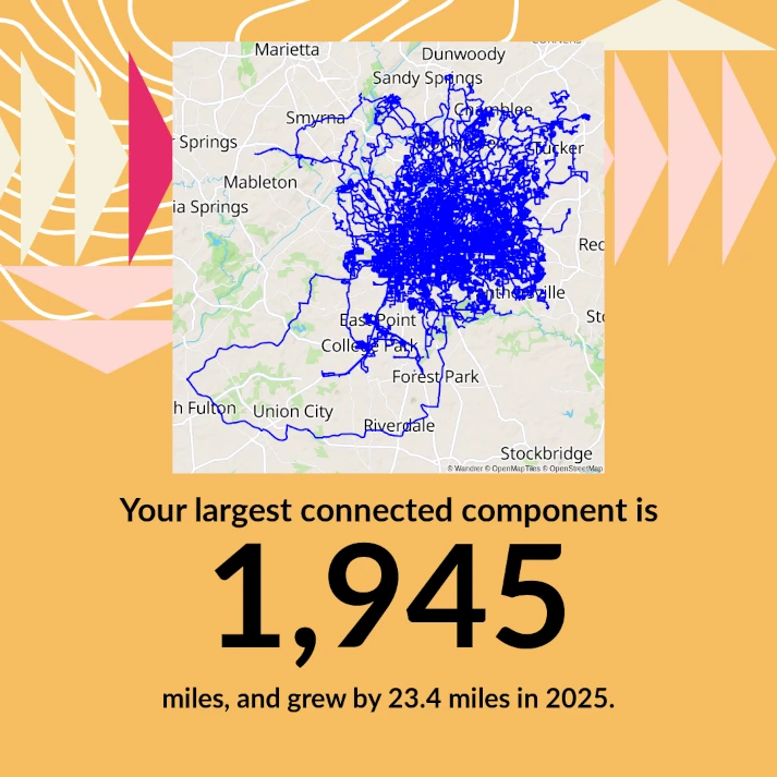
If you haven’t seen it already, your own personal 2025 wrap-up should be visible at https://wandrer.earth/history/2025. And it includes a fun new thing this year: your largest “connected component”! This is basically the biggest blob of roads that you’ve traveled that are all connected to each other.
What does it mean to be “connected”? So that it’s not super tedious about every tiny break, I overlay a grid on to your Wandrer data, and so long as two roads are the same grid cell then they’re connected. The grid can be viewed here. Click the button in the top right to set the level to 16.
This could potentially become an all-the-time feature if enough folks want it, so let me know.
Viewing others’ maps
One of the things many of you requested for how to improve for Wandrer in 2026 was finding some way to view Strava users’ maps again. Viewing other folks’ maps became an issue at the end of 2024 with Strava’s updated data policies and really diminished a nice Wandrer feature, which is to say, being able to see all the crazy places we’re all going.
Because so many folks asked about this, I’m going to see if there’s some way to make things work again. I’ve got some ideas that I’m going to run by Strava and I’ll report back with any updates. Wandrer and Strava seem to be on good terms, so I’m hopeful we can figure something out. Fingers crossed!
Year-only mode

As an experiment for 2026, I’ve introduced a “2026-only” mode on the site. This will calculate your activity progress considering only activities from 2026. Nothing from any prior year will count. Several folks have asked about this in the past as a way of encouraging local exploration again once their “all-time” map has gotten super filled in. At this point there’s basically a year-only version of everything except for the emails / activity description updates. If you’re upgraded, it’s available with the toggle in the top right of the screen. Let me know if you like it!
Focus for 2026
Another big theme I heard from folks for improvements to make in 2026 is overall site stability and reliability. Wandrer is super bursty in that everyone gets outside Saturday and Sunday mornings, and even moreso during the nice weather months. This has resulted in some really long delays for activity processing on the weekends especially, plus slow loading times on the website.
Additionally, several folks reported situations to me of an activity being completed and calculated, but not showing up on their map. Or their stats weren’t reflecting the activity’s progress. Things like this. I have already made a lot of progress on improving this so far in 2026 and I think I can get it even better.
Lastly…
This is a tough one to bring up, but I am planning to increase Wandrer’s price from $30/year to $40/year at the beginning of May. I know this may not be welcome news, and might mean that Wandrer is no longer worth it for many of you. For what it’s worth, here’s my rationale:
- Wandrer’s costs have gone up. Infrastructure is more expensive with AI-driven storage and RAM shortages.
- Wandrer is more complicated than it was 5 years ago (when the price was originally set to $30/year). There’s a lot of things on Wandrer now that didn’t exist then: untraveled roads on your map, support for runs/walks/hikes (plus combined bike+foot), supporting RideWithGPS/Garmin/Coros, the browser extension, exportable maps for Garmin/Wahoo, the Karoo app, regular map updates, routing tools, super-unique/never-traveled roads, the native app, and year-end summaries. There’s just a lot more things to support and maintain.
- By the same token, Wandrer has improved substantially during those 5 years. I think it’s worth an extra $0.83/month at this point.
I hope you’ll stick around, but I understand that you might not. If you were on the fence about upgrading, now’s your chance! If you’re renewing around this time I’ll be getting in touch to make sure you have plenty of heads-up and to lock in the existing $30/year price if you’d like. Thanks!
Related Stories:
A->B routing is live
Following up on the recent post about “100% routing” tools, there are also now some tools to help you plan routes from point A to point B and maximize your new roads along the way. Let me tell you about it!
Read article"100% routing" is live
As much fun as it is to go knock out a bunch of untraveled roads, sometimes you just want to do something without a ton of planning. Wandrer now has “100% routing” tools for you, which will let you easily make a route that covers every road in an area all in one go.
Read article